April 27-28 Passage to Mexico
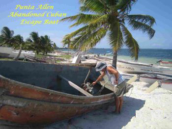
Passage from Maria La Gorda, Cuba to Isla Mujéres, Mexico
**A miserable 34 hours! Yes, the journey confirmed once again that Wendy does not like long passages: not only does the skipper have to deal with the vagaries of the sea, he has a grouchy first mate on his hands too. We left at 0600 and for most of the day, it was sloppy and uncomfortable with big seas, although we made good progress, averaging 5.4 knots. We tried to make as much southing as possible so that we would not have the Yucatan Current on the nose when we turned west. By 1500, we could feel the current and it became stronger and stronger (seemed much more powerful than the Gulf Stream off the coast of Florida) so that we were only making 3 knots for the rest of the journey. We used the genny alone because the main was flagging too much and of course, with one engine and weak winds behind us, we did not have much forward thrust. We were nervous about making it by daylight but we had the anchor down at 1600. Two cruisers came in after us from Florida: they were making one knot against the current so I suppose we did all right.
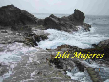
April 28 - May 18 Isla Mujéres (A). Lat 21 14.695N; Lo 086 44.687W
**As soon as we arrived, Chick from S/V 'Conch Quest' dinghied over to give us all the lowdown on checking in and finding things in town. Chick and his partner, Anita, both Americans, had been here two years. Most other flags were US and that was great for us as the Americans cruisers are so sociable.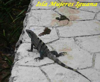
**We dinghied over to Danny (Texan single-hander) on M/V 'X-Isle, a few hours later and gave him the lowdown too. In fact, we were to see Danny right through Belize and we shared many meals and visits together.
**Took us six days to clear into Mexico! All very relaxed but what a rigmarole. Of course, no one was available on the Sunday we arrived. On Monday, we first went to the clinic to fill out a form for the doctor stating that we were healthy. Next, we went to the immigration officer who informed us that we had to pay our fees at the bank, not to him directly (apparently to prevent 'mordida' [bribery]), and get lots of photocopies of documents. Next, we visited the port captain, who informed us that we had to take the ferry to Cancun to pay the fees to another bank! However, we had to wait another day to do that as his computer was down. Tuesday was Labour Day in Mexico and so everything was closed. Well, well, well - clearing in was one thing that was easier in Cuba. You just waited until officials came to the boat. The fees ended up being $100+ in Mexico. No one came aboard our boat so you wonder what all the fees support.
**After discussing our engine problems with all and sundry, it apparently came down to a faulty fuel pump. And indeed, that was the problem. So our purchase of the extra fuel pump in Puerto Rico was not wasted after all. Engine works great (June, 2007).
**Wendy volunteered to be the net controller for the VHF Cruiser's Net for 3 days. Hey, that was fun.
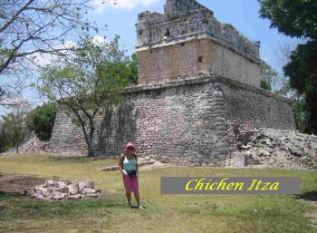
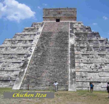
**We took a bus tour to Chichen Itza, a Mayan ruin. Very interesting but oh so commercialized.
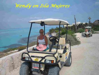
**We rented a golf cart one day and enjoyed the nice breeze and the slow pace. We visited some ruins, a park and a turtle farm (not for eating) at the south end of the island.
 |
 |
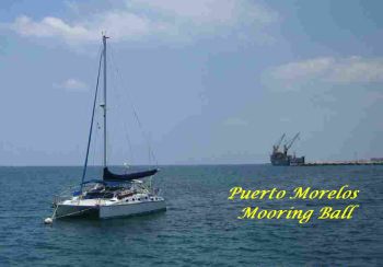
May 19-20 Puerto Morelos (M). Lat 20 50.769N; Lo 086 52.412W
May 21-22
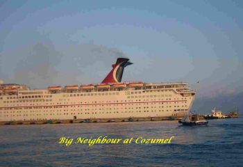
Cozumel was a disappointment. Very touristy with 2-3 big cruise ships at dock every day. Poor holding at anchor (but luckily calm weather) and no place to go ashore with dinghy. We ended up dragging it up on the sand/coral shore and getting swamped.
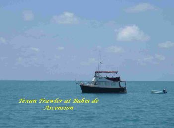
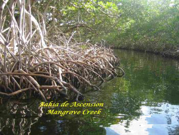
May 23-25 Bahia de la Ascension (A). Lat 19 46.949N; Lo 087 29.337W
 |
 |
 |
 |
May 26 Bahia del Espiritu Santo (A). Lat 19 21.676N; Lo 087 31.222W
We travelled to the next bay with the main and genny . It was a bit of a bumpy ride with the big east swell and there was the usual tricky reef entrance to negotiate. Danny, a very generous guy (M/V X-Isle), was nearby and he brought us some fresh catch. We were visited by the park rangers, four of them, who tied up alongside in their panga. We had watched them spend an hour with Danny before they visited us and wondered what was up. However, our visit was short and friendly and we all struggled along in our 'Spanglish'. Glad to see they have park rangers protecting these areas.
May 27-28 Cayo Norte, Chinchorro Bank (A). Lat 18 45.008N; Lo 087 18.418W
May 29-30 Xcalak (A). Lat 18 16.704N; Lo 087 49.908W
We took off early again (0545) for the 9-hour journey to Xcalak (pronounced ickshcalack), our last port in Mexico. The ride was much more comfortable (of course, going west) . The reef entrance was very tricky, again, and it would be suicidal to try to go to these places in the dark. We went ashore to the quiet little town and had dinner at Sylvia's. It is getting much more humid (seems impossible to get more humid) as we approach the rainy season. The water temperature is consistently over 85F now. On our last day in Mexico, we cleared out with the port captain, Jorge, who was very friendly and implored us to visit longer next time.
**All in all, we loved Mexico. Wonderful people. Very good prices for everything. Beautiful cruising. Looking forward to going back at the end of the year. Yes, we have changed plans again. Wendy is very certain that she does not want to cross an ocean. We will probably head back to US, perhaps as far north as Maine and then we want to do the Caribbean all over again, continuing around clockwise, including Venezuela, Columbia and Panama. We love cruising but not long passages (at least not for Wendy).
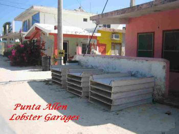
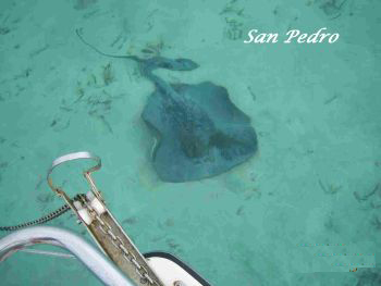
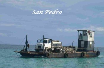
May 31 - June 02 San Pedro, Ambergris Cay (A). Lat 17 55.005N; Lo 087 57.626W
Clearing in was easy and free! Whew, that's a switch. In fact, we heard of another cruiser who had checked in at Belize City and paid $80. Something strange about that though it seems that if you go into the big ports that handle big ships they do not always know what to do with small pleasure craft, and you end up paying more.
There was lightning and rain in the night and I guess we will be getting lots of that from now on, as the rainy season begins in June. The humidity is very high and we finally decided to move the bedding back up to thesettee area to take advantage of the breeze from the forward hatches. I checked the diary and we did the same thing on almost exactly the same day last year in Martinique, though note that Martinique is at a lower latitude so we did not wait so long this time!Definitely much more accepting and savvy about the heat. We rented a golf cart, stocked up on supplies and did a little exploring on Ambergris Cay.
 |
 |
June 3-4 Cay Caulker (A). Lat 17 44.651N; Lo 088 01.840W
It was a short ride to Cay Caulker on a hot and steamy morning. Many other boats were anchored at this laid-back place, including several boats we had met at Isla Mujeres (S/V 'Gypsy Breeze' [US] , S/V 'Septum' [Canada], S/V 'Tranquility' [UK], M/V 'X-Isle' [US], S/V 'Mangara' [UK] and S/V'Island Time' [US]). We did the usual: laundry, Internet, book exchange, bank, lunch at Syd's and general sauntering around to en joy the locals and the ambience. The water temperature is now 88F.
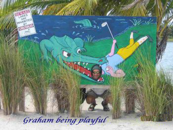
June 5-6 Chapel Cay (A). Lat 17 41.390N; Lo 088 02.802W
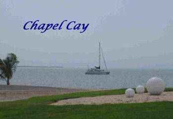
In the afternoon, we went ashore and the manager of the gorgeous resort/golf course gave us permission to stroll their grounds. We saw lots of birds and a small crocodile in the freshwater pools around the golf course. Not the place to go chase your golf ball if it strays from the green! The wind held to 20 knots all night
June 7-9 Caulker Cay (A). Lat 17 44.675N; Lo 088 01.848W
With high winds forecast for the next couple of days, it was one of those awful 'should we or should we not?' Decision-making times. We decided to go back to Cay Caulker with its better protected anchorage and more variety ashore. Good decision. Did the usual: laundry, Internet, shopping, bakery and lunch at Glenda's. Danny called us on the VHF in the middle of the night (he knew we were up as he heard us on the radio warning another boat that they were dragging . We just happened to wake up at the right time as we heard the high winds and went outside to check on our holding, as usual). He himself had dragged at Long Cay and he also came back to Caulker Cay.
 |
 |
 |
 |
The winds gusted to 30 knots on the third night but we were holding fine. Not so for three, yes three, of the big charter cats. We tried to hail the first one on the radio to no avail as everyone was probably asleep. We were about to put down the dinghy and dash over to help but first decided to use the spotlight. Another boat did the same thing and that finally roused someone and they quickly started their motor and re-anchored. As we kept anchor watch, two more of the big cats dragged. One dragged on top of another private cat and we heard the heated verbal exchange as everyone re-arranged their anchors. Another anchored right in front of us so we turned on all our lights and they finally got the picture that they were too close and moved away. An exciting night.
June 10 St. George's (A). Lat 17 33.202N; Lo 088 04.859W
We woke up to a very unusual NW-W wind but it was only 4 knots. We made our way through the tricky Porto Stuck, actually going on the wrong side of some of the buoys in spite of having previously been through the dreaded spot twice on the ferry. Ha, you never know. But we are very cautious and go at slow speed when the depth gets to 4-5 feet so there were no problems. No wonder the deeper draft boats have to stay on the outside of the reef. St George's Cay was lovely ashore and we enjoyed our sundowners ashore with Danny at the only open resort.

Another lovely spot. A good snorkel and swim. We dinghied around some extensive mangrove lagoons.
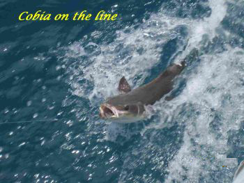
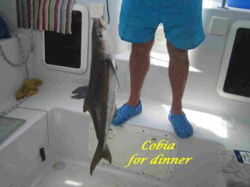
June 12 Blue Ground Range (A). Lat 16 47.987N; Lo 088 09.408W
Seven+ hours of easy cruising. Total relaxation. Caught a 2 ft cobia (wethink) and put it back. Tricky anchoring in the thick turtle grass. Beautiful cay. A bit of a rolly and restless night. OK, we need some civilisation again and so we'll go right to Placencia.
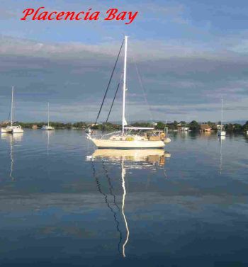
June 13 - 14 Placencia (A). Lat 16 30.609N; Lo 088 21.799W
June 15 Monkey Bay (A). Lat 16 24.062N; Lo 088 27.733W
The two-hour journey to this beautiful protected anchorage was easy on a flat calm morning. Oh yes, the 'island' marked on the chart was actually submerged and we somehow managed to touch bottom on one tiny end of it, with the million to one chance of doing that. Well, actually, we heard a swoosh as it skimmed over the soft bottom but did not actually feel any change in motion. Graham quickly reversed but I could see the deep water ahead and yelled for him to keep going. Probably scraped a little more crud off the keels. Hey, only the second time we have done this in over a year. One of the experts reported in his guidebook that he went aground over 40 times. We rigged up the air conditioner, drooling in readiness to start running it at the marina.
June 16 New Haven (A). Lat 16 15.132N; Lo 088 35.544
Another calm and beautiful anchorage. We are keen to move on but a 20-25 knot wind is forecast so we'll take it easy. The winds did not materialise
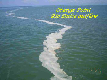
June 17 Orange Point nr Punta Gorda (A). Lat 16 04.673N; Lo 088 49.049W
June 18 El Golfete, Guatemala (A). Lat 15 49.402N; Lo 088 44.860W
We got to busy Livingston and anchored out with two other boats (UK), all waiting for official clearing in. We were last in line but they were quick and five officials came on board, including the doctor. Very informaland organised. They gave us a map and told us where to find each of the offices (customs, immigration, police) in town. Wow, that's a first. The fees ended up costing almost $100 (for what?) but it is hard to begrudge the money in such poor countries. And we will be here for several months.
We went ashore to this very interesting town, with a real mix of people: Mayan, Creole, Garifuna, Gringo, etc. We invited a friendly Garifuna, Polo, to have lunch with us. He spoke perfect English and had been to the University of Chicago at the expense of Jerry Garcia (Grateful Dead) many years ago. He ran a co-op and an orphanage and asked us to donate any old books (which we did, of course).
Now came the spectacular journey up the canyons of the Rio Dulce. Really truly awesome. We did not want the journey to end, even in spite of the heat, and decided to anchor out on Lake El Golfete rather than press on to Rio Dulce town (also known as Fronteras). The anchorage was so peaceful and we loved watching the families moving about on their Cayucos. No roads or automobiles that we could hear. Many Cayucos moved along silently with a single paddle and others had outboards. Tiny sparrows rested on our lines. It seemed like a magical place
The rain and lightning in the night seemed like the most dramatic we had ever experienced. Twice, we had to pull the plug from the dinghy (on the davits, as it is every night). At 0200, we decided to shower on deck. That felt a lot better and we slept well afterwards. (Note: Nothing on our boat leaks and we are always totally dry inside - it is indeed a 'dry' boat. Another Note: no swimming as we are not sure about crocodiles in the fresh water.)
June 19 Mario's Marina, Rio Dulce (M). Lat 15 40.476N; Lo 088 58.917W
The morning was gorgeous as we moved up the river for another couple of hours. The water temperature is now 90+F. We arrived at Mario's Marina (previously booked via email) and dock master Marco took over and manoeuvred us into our spot. We are stern-to, with a plank to the dock, and several lines tied up to the boats beside us. There is another line of stored boats in front of us, all tied to mooring balls and juggled around as the inside boats come and go.
So far, we love it here. Very relaxed and pretty grounds. A lovely little cool pool where we have soaked every afternoon. A nice family from Texas, with three kids, triplets, beside us on a big monohull. Air-conditioner plugged in. Lots of happenings and interesting town with good provisioning. All for $185 per month plus electric plus $30 per month for WiFi. We are enjoying the socialising and doing lots of projects on the boat. Life is good. Spanish classes (free) will start in a couple of weeks.
Tomorrow we are taking the bus to Flores to visit some Mayan ruins at Tikal. It'll be a three-day trip. Lots of other adventures planned and we will keep you posted although we probably will not submit another log until much later as we are staying put in the lovely Rio Dulce (so much to see inland in Guatemala) and we'll be spending all of August and half of September in Canada. When we get back from Canada, the plan is to visit the Bay Islands of Honduras and perhaps return to Isla Mujeres, Mexico, for Christmas.
Be sure to read the other instalments of Wendy and Graham's journal
The Adventure Continues.... 2007: